Virtual Property Tour
Virtual Property Tour
“Experience real estate like never before – Guruji8earth crafts virtual property tours with Google Earth Studio, unlocking immersive journeys that redefine how buyers explore and connect with their property”
Welcome to Google Earth Studio Virtual Property Tour
What’s included:
- Fly Over Animation: Breathtaking aerial views that engage and impress.
- 2D Route Animation: Showcase routes effectively with clean, easy-to-follow visuals.
- 3D Route Animation: Add depth and realism to your routes for an immersive experience.
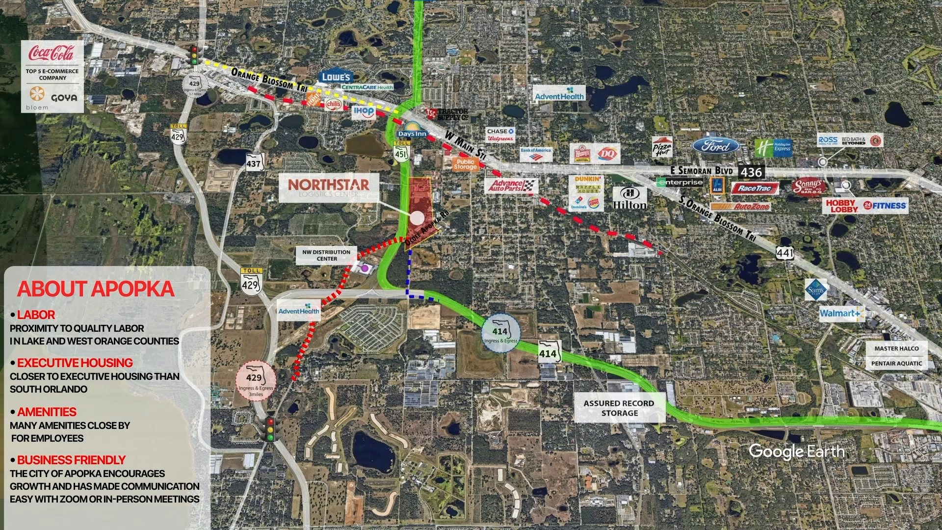
- 3D Markers: Highlight key points in a stunning three-dimensional space.
- Call Outs: Concise annotations for clear information delivery.
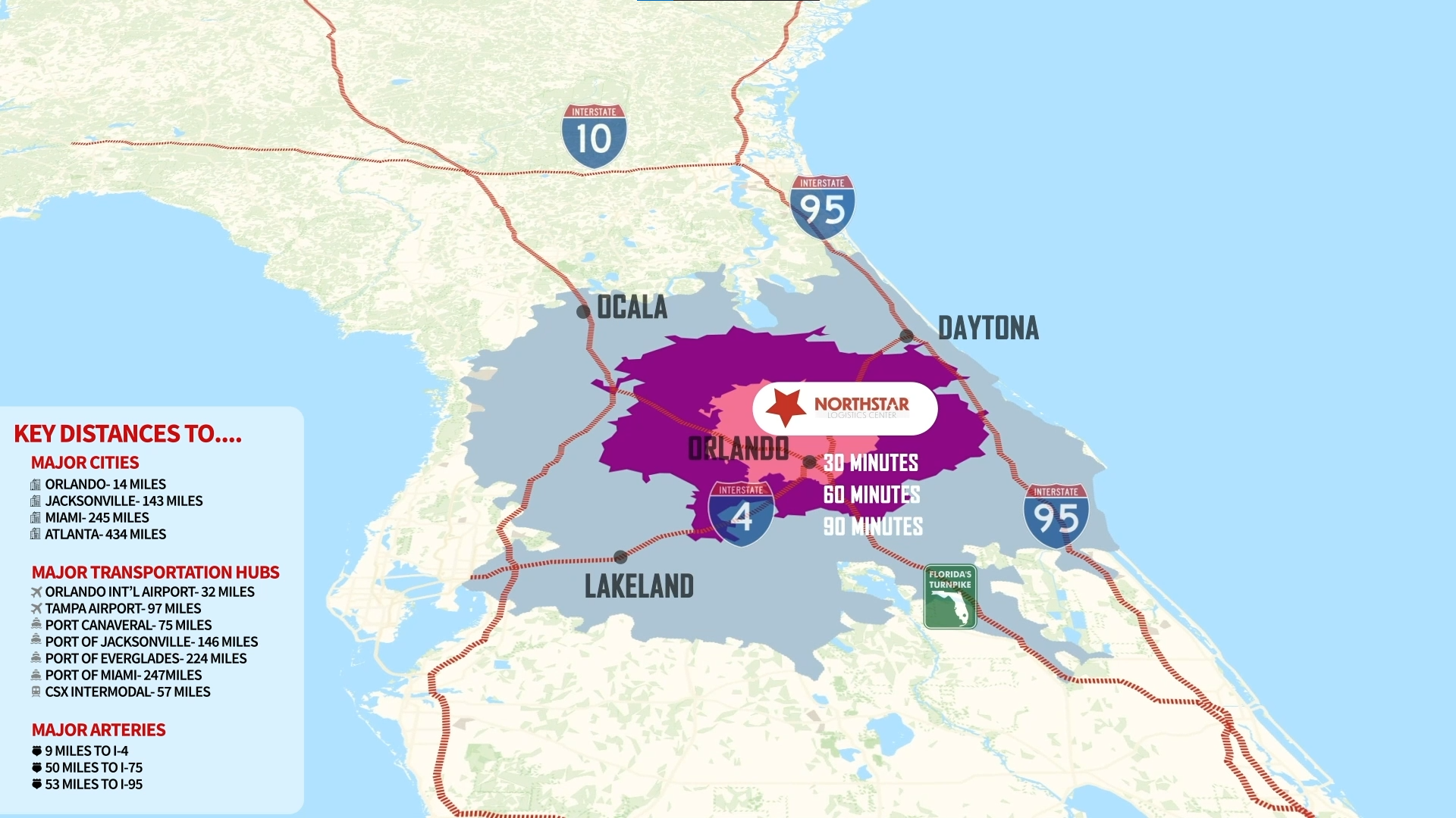
- Distance Heat Maps: Visualize distances with dynamic heat maps.
- Digital Counter: Showcase statistics dynamically.
- Elevation Graphs: Illustrate altitude changes seamlessly.
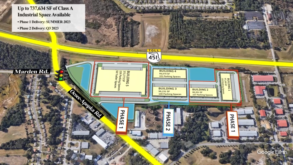
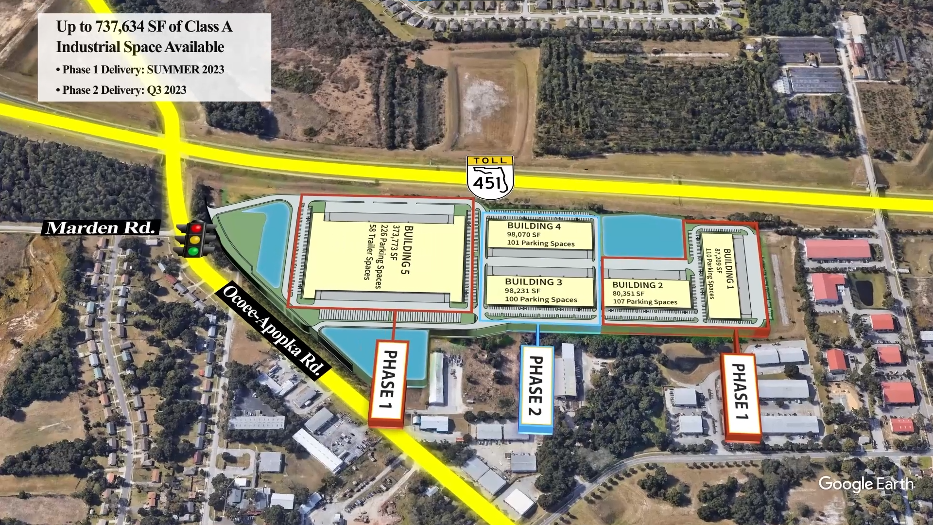
- Plot Overlay: Map your Site Plan over the actual real life location.
Project summary :
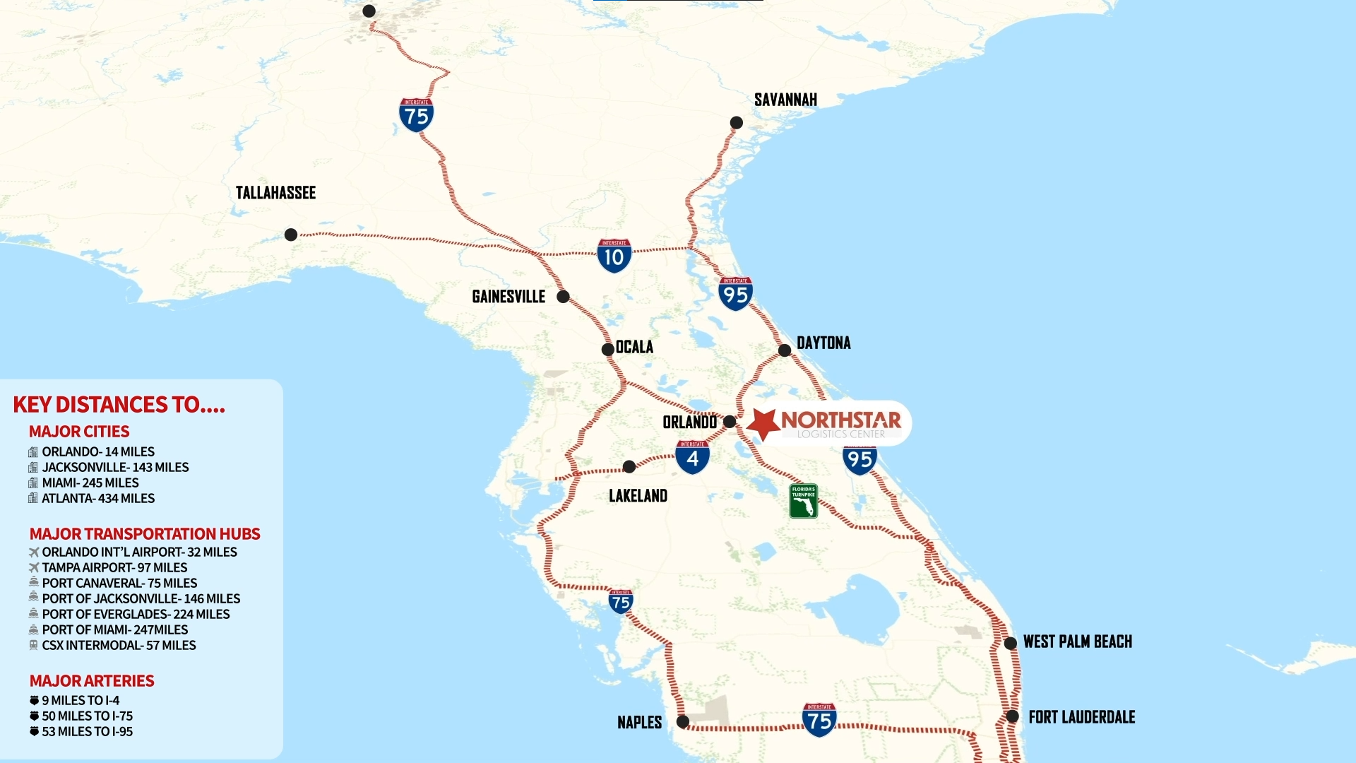
Gena wanted me to design a virtual Property Tour for the Company NorthStar. Having provided me with all the details that must be shown in video like major roadways connecting major cities and airports as well. It also includes site plan, company brochure, branding and contact details of the realtors.
The Virtual Property Tour is an amalgamation of 6 layers of footage that contains:
- TOP DOWN SHOT 1 : SATELLITE VIEW
- TOP DOWN SHOT 2 : HEAT MAP
- TOP DOWN SHOT 3 : BIRD'S EYE VIEW
- PROPERTY OVERLAY
- COMPANY DETAILS
- CONTACT PAGE
“Guruji8earth brought our Florida properties to life with an immersive virtual tour. The dynamic visuals and attention to detail not only showcased the beauty of each location but also set a new standard for our Northstar brand. A seamless and impressive collaboration that exceeded our expectations!”
Gena
Marketing Strategist
What is Top Down Shot 1 : Satellite View?
What is Top Down Shot 2 : Bird's Eye View?
What is Site Plan Overlay?
What is Site Plan Overlay?
What is Heat Map Animation?
What is Renders and Contact Page?
Licensing Terms?
Client Details
Gena,Marketing Strategist
Service Provided
Local Business Logo Research, Location Research, Route Animation, Satellite View Animation, Bird's View Animation, Heat Map, Video Editing, Contact Page
Project Timeline
2 Days planning, and 2 Week for completion
Our Other Projects
- Website Hero
- 3D Fireball Route Animation
- Cinematic Video
- Route Animation
- Race Track Animation
- Drone Fly-Over Animation
- Social Media Content
- Geopolitical Documentary
- Map Animation
- Geolayers Travel Route Animation
- 3d Sliced Landscape
- Infographic Animation
- 3d Globe Animation
- Race Animation with Tracked Data
- Timeline and Data Animation
- Real Estate MarketPlace Website
- Real Estate Branding Services
- Real Estate Website to App
- Drone Video Editing Services
- Real Estate Video Editing
- Real Estate Social Media Marketing

Deepesh Kumar Nirmalkar
Hi there, I am seasoned Map Animation and Motion Artist 😎. Internet Technologies, Science, 3D, Geography fascinates me🤩. This website is very close and dear to me and is one of my personal projects - Guruji8Earth 😍. I aim to bring the power of map animation to everyone either through rendering my services or narrating / sharing stories that involve geographical map animation 🌍.
